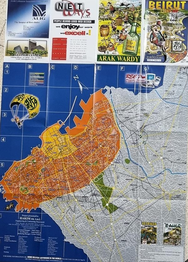


Beirut Toon Town Map
$ 11.20
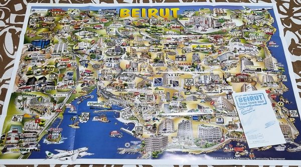
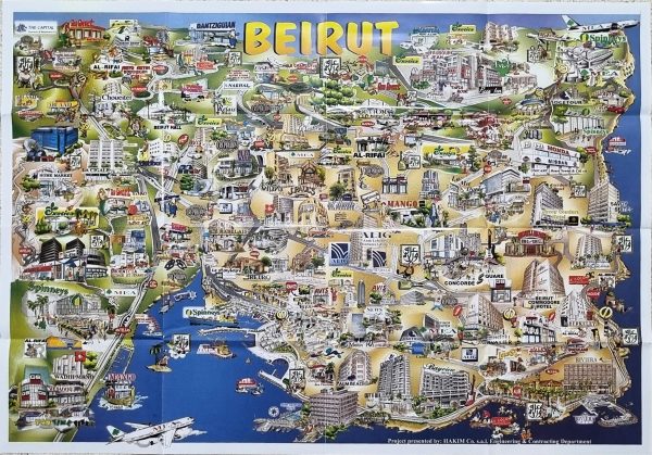
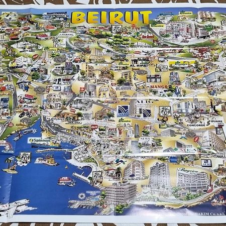
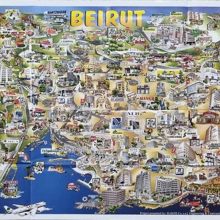
Beirut Lebanon “Toon Town Map” 97×68 cm (recto-verso).

100% Made in Lebanon - صنع في لبنان
- Description
- Shipping & Return
Description
LebanonPostcard offers an old charming map of Beirut Lebanon “Toon Town Map” Guide 1998.
The Map is 97×68 cm (recto-verso) and licensed by the minister of tourism: Application No 3358, approval date 11/10/95, NO 1/22, approval date 16/7/96.
– Special thanks to the minister of tourism M. Nicolas Fattouch for his large support and commitment.
– This caption refers only to the buildings, companies, institutions, and landmarks present on the toon town map.
All rights reserved – Approximative scale: 1/12500
This map was designed to serve as a general guide for people visiting Beirut. We have tried to make the map as reliable as possible yet at the same time aiming to keep the map simple and easy to use. In closing, we thank you for choosing our product and we hope you like using it as much as we enjoyed making it for you.
Although every care has been taken to ensure that all the information is correct in this publication, the publishers do not accept responsibility for any inaccuracies.
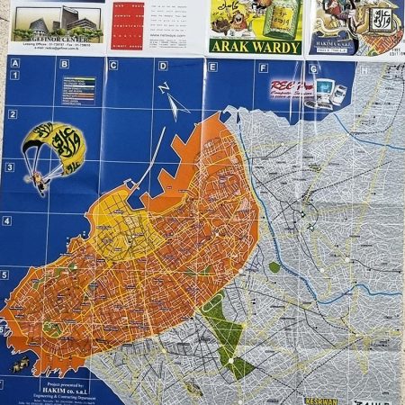
The maps show the highways, principal roads, secondary roads, streets, green zone, sea and rivers, city center, Beirut city, suburbs, and roads under construction.
The booklet contains an introduction to Beirut, its Geographical situation, History, what to see in Beirut, what to do, and where to shop. Useful telephones, sites, embassies, hotels, commercial centers, restaurants, notes and more…
LebanonPostcard will be responsible for sending the map you order, through a fast courier with a tracking number, guaranteeing reception of the package. The map may take between two and five days to arrive, according to the country it is sent to.
a. View or Modify What is in Your Shopping Cart.
When in the Shopping Cart area of the site you can view or modify what is in your shopping cart at any time by clicking on the Add More Items/Refresh Totals button along the bottom of your screen.
b. Checking Out and pay for your purchases online.
When you have finished viewing and wish to end your shopping and pay for the items you have selected, click on the Pay & Finish button at the bottom of your screen.
You will be led through a series of secure ordering procedures and will be asked to fill in personal, shipping and payment option information. When this is completed, you will press the Submit Secure Checkout button and your order will be transmitted to LebanonPostcard for fulfillment.
Absolutely not! Right up until the point why you are asked to review the order information you have given us and if it is correct to click on the final Submit Secure Order button, you can abort the order.
If you don't press the Submit Secure Order button then no order information is transmitted to us.
a. Payment by Credit Card
We accept American Express, MasterCard, Visa, Discover, PayPal... etc... for online payments through 2CheckOut.com. Also, arrangements can be made for bank draft and certified check payments by regular post.
b. Payment by Bank Draft and Certified Check
If you would prefer to pay for your purchases by mail, then you have to contact us first so we can give you our account information.
c. We accept as well payment through WesternUnion, RIA, OMT, BOB Finance, Whish Money.
All prices include shipping and handling. LebanonPostcard will be responsible for sending the packages you order, at your charge, through the service D.H.L. / E.M.S. with tracking number code guaranteeing reception of the package.
We ship as soon as possible, but within maximum 4 days after the order is received.
Credit cards are not charged until we actually ship the items. The items may take between one and six days to arrive, according to the country they are sent to.
Packages are sent with track code to guarantee reception, and delay is rare. In the event of non-delivery or delay, nothing can be done for 7 days. At the end of this period, on our being informed, a demand will be made for the package to be traced. If 14 days after the first dispatch there is still no delivery, a second package will be sent free.
Packages inside Lebanon are sent registered through LibanPost to guarantee reception, and delay or non-delivery is rare. In the event of non-delivery, nothing can be done for 6 days. At the end of this period, on our being informed, a demand will be made to LibanPost for the package to be traced. If 12 days after the first dispatch there is still no delivery, a second package will be sent free.
We ship anywhere in the world. Zones and countries we ship to
Yes. You can cancel you order when you receive an email from us confirming your order, you can reply by canceling it.